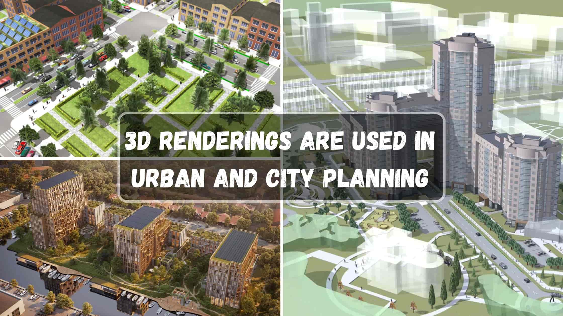
Urban and city planning has also gone through an amazing transformation with time, and the driving force for this is technology. Perhaps the most forward-thinking tool of today is 3D rendering. It is a technology that helps architects, town planners, and builders to pre-visualize cities in extremely detailed and interactive terms before building them. Right from more effective planning of infrastructure to facilitating sustainable development, 3D renderings are today an integral part of planning tomorrow’s cities.
Being one of the best 3D rendering firms, Bottomlinestudio is adept at creating photorealistic and interactive visualizations that aid in decision-making in urban and city planning. Through this article, we learn five amazing ways 3D renderings are revolutionizing the business and shaping the cities we call home.
1. Improved Urban Infrastructure Planning
One of the best uses of 3D renderings is in urban planning and visualization of urban infrastructure. The roads, bridges, public transport, and power transmission lines must be well planned so that they are efficient and effective. Otherwise, cities will be plagued by inefficiencies that will be reflected in increased costs, delays, and long-term infrastructure issues.
How 3D Renderings Help
Proper Road and Traffic Planning: 3D models can be used by town planners to design roads, intersections, and highways with optimal traffic flow, making roads less congested. 3D models can provide simulations of different traffic conditions, allowing possible bottlenecks to be evaluated and improved pedestrian and cyclist safety features.
Detailed Public Transit Plans
Trains, buses, and metros are easy to map, allowing for the simulation of passenger movement and indicating potential issues. Planners can verify the optimal position for transit hubs, bus stops, and pedestrian pathways through realistic 3D images.
Integration of Utility Infrastructure
Utilities such as water supply, sewage, power supply, and telecommunication infrastructure can be designed to the point that its efficiency and integration with urban planning is guaranteed. 3D visualization allows engineers to design utilities underground and avoid costly errors on-site during construction, which reduces interruptions in operational city services.
Urban Resilience Planning
Urban planning needs to be done in terms of resilience today regarding natural disasters, climate change, and increasing populations. 3D visualizations can allow planners to create flood maps, earthquake hazard, and stormwater runoff patterns so that the city will be able to operate and safely go on regardless.
Construction Feasibility Analysis
The instant soil is ever disturbed on megaproject infrastructure, 3D renderings facilitate stakeholders to assess feasibility because they can get a full impression of the construction site, the surrounding terrain, and potential conflicts. It decreases the chances of calculation errors and maintains the overall project in a more efficient state.
By incorporating 3D visuals into infrastructure planning, urban planners are able to create smarter, more efficient cities at lower costs and higher quality of life for residents. High-precision visualizations allow for better decision-making, with urban development occurring in harmony with long-term development goals as well as with environmental sustainability initiatives.
2. Creating Realistic Architectural Visualizations

Skylines of a city are defined by the buildings contained within, and 3D visualization enables architects and property developers to visualize the building before it exists. Whether the design is for—a residential complex building, a business hub commercial, or a tower—the 3D visualization envisions how the building will appear visually and physically when it is in position. Architects are optimistic that building design will follow in harmony with function and the demands of beauty through the use of 3D visualizations so as not to suffer from the inadequacies of badly thought-out designs after buildings have already been completed.
Advantages of Using 3D Rendering for Architecture
Precise Design
The design is adjustable by architects according to the real circumstances such as light, shadow, and material. It is possible to visualize other materials and textures’ usage in precise detail that supports the selection of the best choices for durability and aesthetics.
Enhanced Coordination
Architects, engineers, interior designers, and city planners can all coordinate harmoniously with 3D visualizations. Sharing true digital models ensures that better communication is achieved such that all parties are on the same page about the vision for the project.
Stakeholder Engagement
Investors and developers can view real-time simulation of projects before investing in resources. Using interactive visualization, stakeholders can visualize different designs, making decisions that enhance the viability of the project.
Cost and Time Savings
Planning-stage design changes through 3D Rendering Services in USA save time and money on the table compared to changing structures after construction has begun. Planners can identify problems early, preventing rework and delays.
Public Input and Awareness
The people of the city can view upcoming developments and provide their opinions, ensuring that development aligns with the wishes of the public. Interactive 3D presentations educate the masses about how new constructions will reshape the neighbourhood, making the projects transparent and trustworthy.
Realistic Sales and Marketing Presentations
With better 3D pictures, developers can use them for marketing campaigns, showing properties to potential buyers prior to construction. This allows for funds and pre-sales to be raised and secured, and projects gain a head start in finances.
With Bottomlinestudio’s skills in architectural drawings, urban planners are able to create stunning visuals that maximize planning and realization. The power of 3D drawings ensures every detail of a city, from skyscraper high-rises to pedestrian malls, is planned specifically for purpose, sustainability, and beauty.
3. Green and Eco-Friendly City Planning

Today, sustainability is the largest issue in city planning. Planners, developers, and governments no longer only care about constructing without any consideration of their environment for their own good. They use 3D visualizations to aid in their decision-making in calculating their environmental impact as well as in green optimization designs. Through the application of 3D modelling when they are planning sustainably, cities are able to harmonize their developments in relation to environmental levels and improve residents’ quality of life.
How 3D Renderings Enable Sustainable Development
This allows for the best placement of solar panels, energy-efficient window location, and building location for best passive heating and cooling. Wind simulation can also be employed to determine the optimum placement of wind turbines in cities.
Green Space Integration
Parks, green roofs, and gardens can be planned with defined measurements to increase biodiversity and air quality. Through 3D visualization, city planners can conceptualize green corridors, green roofs, and urban forests as effective and beautiful pieces of infrastructure. They lead to better mental well-being and social health among residents of cities and reduce urban heat island effect.
Waste and Water Management
Smart simulations help plan effective waste evacuation and water management systems that make the city more sustainable. The planners can include smart drainage systems that reduce flooding, construct rainwater harvesting underground tanks, and improve waste recycling plants. Looking at these elements through 3D models ensures that these are planned with the most effective spatial relationship for urban sustainable waste and water solutions.
Green Transportation Planning
3D visualizations enable the planning of non-motorized roads, bicycle facilities, and electric vehicle charging stations to advance green mobility. Urban planners can design traffic economically with a lesser carbon footprint with simulations by including special public transportation roads, multiple modes of transportation centers, and traffic-free roads.
Energy-Efficient Building Designs
Architects can imagine energy-efficient building designs using 3D visualization by merging smart technologies like insulated glass, natural ventilation, and energy-efficient materials. The visualizations make the buildings meet international energy standards and assist in promoting the sustainability cause in the long term.
Carbon Footprint Reduction
One can measure and demonstrate the carbon footprint of development before it is built from 3D visualizations. This will enable developers to alter material, transport planning, and power sources in an effort to minimize the green footprint of city projects.
With the visualization of city planning through 3D renderings, city planners are able to move beyond green solutions and make prudent decisions in line with the vision of a sustainable world. Such advanced visualizations provide information on long-term environmental influence, allowing cities to embrace a sustainable lifestyle. Through AI simulation-based 3D simulation and virtual reality walkthroughs, urban planners can design more resilient and flexible urban spaces in such a way that they are able to maintain the growth and preservation of nature as well.
4. Intelligent City Design and Digital Twins
Intelligent cities rely on data-driven city planning, and 3D rendering technology is involved significantly in developing digital replicas of current environments. A digital twin is a virtual representation of a city, grounded in live data, and allows planners to forecast and simulate urban activity. The new city planning method renders urban spaces more efficient, resilient, and sustainable by giving decision-makers a vision to look through past pitfalls and optimize resources in response.
Applications of Digital Twins in Urban Planning
Predictive Modeling
Governments can simulate different scenarios, such as traffic patterns, emergency response time, and public safety. By simulating scenarios within a city in a virtual environment, planners can identify bottlenecks, forecast disasters, and employ proactive mechanisms to enhance city resilience.
Infrastructure Surveillance
Engineers can track the condition of roads, bridges, and buildings to detect issues before they are too severe. With real-time data from IoT-capable sensors being fed into digital twins, urban planners can track wear and tear, schedule maintenance, and prevent infrastructure collapse.
Optimization of Public Services
Public facilities such as electricity, water, and waste management can be optimized more effectively using real-time visualizations. Digital twins provide an end-to-end view of the usage patterns, and the government can allocate energy, avoid wastage of water, and reduce waste collection routes.
Environmental Impact Assessment
Planners are able to evaluate the environmental effect of urbanization using digital twins. Air pollution, noise, and energy consumption can be simulated to allow policymakers to refine policy to create cleaner and healthier spaces.
Traffic and Mobility Planning
Congestion in urban traffic is a massive problem, but with digital twins, city planners will be able to model the actual movement of pedestrians and automobiles in real time. Based on traffic streams, they will be able to plan intelligent intersections, optimize the public transportation system, and introduce adaptive traffic lights to improve mobility.
Disaster Response and Emergency Preparedness
Digital twins are also beneficial in disaster response since they simulate earthquakes, floods, and fire. Emergency responders can use the simulations to create better evacuation tactics, deploy resources, and lower casualties during emergencies.
Energy and Smart Grid Management
Renewable energy systems are being adopted in a large way by cities, and digital twins make it possible to optimize the distribution of energy. By combining solar panels, wind farms, and battery storage within digital models, cities are able to achieve energy efficiency and sustainability goals.
Real Estate and City Planning
Developers can decide the impact of new buildings on a cityscape, infrastructure, and society through the help of digital twins. The models allow for optimization of land use, prevent urban sprawl, and make architectural integration easier.
With the combination of 3D visualization and analytics based on artificial intelligence, the city is made more efficient, operational costs lower, and quality of life increased overall. The future of urban planning is in digital twins, where blueprints are traded with dynamic, data-driven city models that respond to real conditions. With the advancements in technology, the smart systems will play an ever-growing role in designing cities of the future.
5. Community Engagement and Virtual City Tours

Good urban design is a matter of people and public involvement. 3D visualizations allow urban planners to describe their projects in a very interactive and understandable way, and it is easy for communities to imagine what will be built. Interactive experience capabilities make people more open, confident, and enthusiastic, and urban development projects more effectively address their needs and desires.
How 3D Renderings Foster Community Engagement
Virtual City Tours
Citizens are able to walk through proposed developments virtually, seeing alterations before they are made. Virtual tours are an interactive experience since citizens are able to visit new city proposals, see greenspaces, and interact with virtual cities. This is especially helpful for large projects like commercial zones, transport hubs, and housing complexes.
Public Input Incorporation
Public opinion towards future city planning enables planners to make developments according to the wishes of the people. People can raise concerns, suggest modifications, and participate in planning through participatory 3D spaces. Feedback ensures participation and ownership of urban development.
Educational Resources
3D visualizations can be utilized by schools and institutions to educate children on urban planning, sustainability, and architecture. With the use of 3D renderings in education curriculums, children’s minds are able to have a grasp of the city planning process, sustainable design practices, and infrastructure’s role in building communities.
Public Presentations and Community Meetings
Instead of relying on static blueprints or technical writings, urban planners can use 3D imagery to deliver propositions at public presentations. Such interactive visualizations convert complex architecture and engineering concepts into something more comprehensible for lay people.
Historical and Cultural Preservation
Restoration of historical neighborhoods can be achieved through 3D visualization such that citizens are able to see and enjoy the cultural heritage of their city. Interactive visualizations save landmarks, ensure new constructions are complementary to historic sites, and enable preservation of heritage.
Urban Renewal and Redevelopment
3D visualizations allow the public to see how formerly quaint but now neglected neighbourhoods can be redeveloped to become thriving successful areas. By drawing attention to potential enhancements to public spaces, transport networks, and parks, planners can create interest and persuade citizens to participate in city restoration.
With advancements in VR (360 Virtual Reality Service) and AR (Augmented Reality), 3D visualizations are making urban planning more open and participatory, which has made communication between planners and the public more effective. As participatory tools become digital, they will be working even harder to close the gap between dreams and reality so that urban space reflects the vision of the people it serves.
Conclusion
The role played by 3D rendering technology in city and urban planning is simply enormous. Right from making the designing of infrastructure more productive to green building and smart city development, 3D visualizations are transforming the way cities are being developed and governed.
Being a 3D rendering solution provider, Bottomlinestudio is committed to providing high-quality visualizations which help city planners, developers, and architects design future-proofed cities.
By applying 3D renderings, cities are able to maximize their resources, effectively engage communities, and create better, more sustainable spaces for future generations.
If you’re seeking innovative 3D rendering solutions, Bottomlinestudio is ready to help bring your urban planning ideas to life with accuracy and vision.